About Lyngsalpan
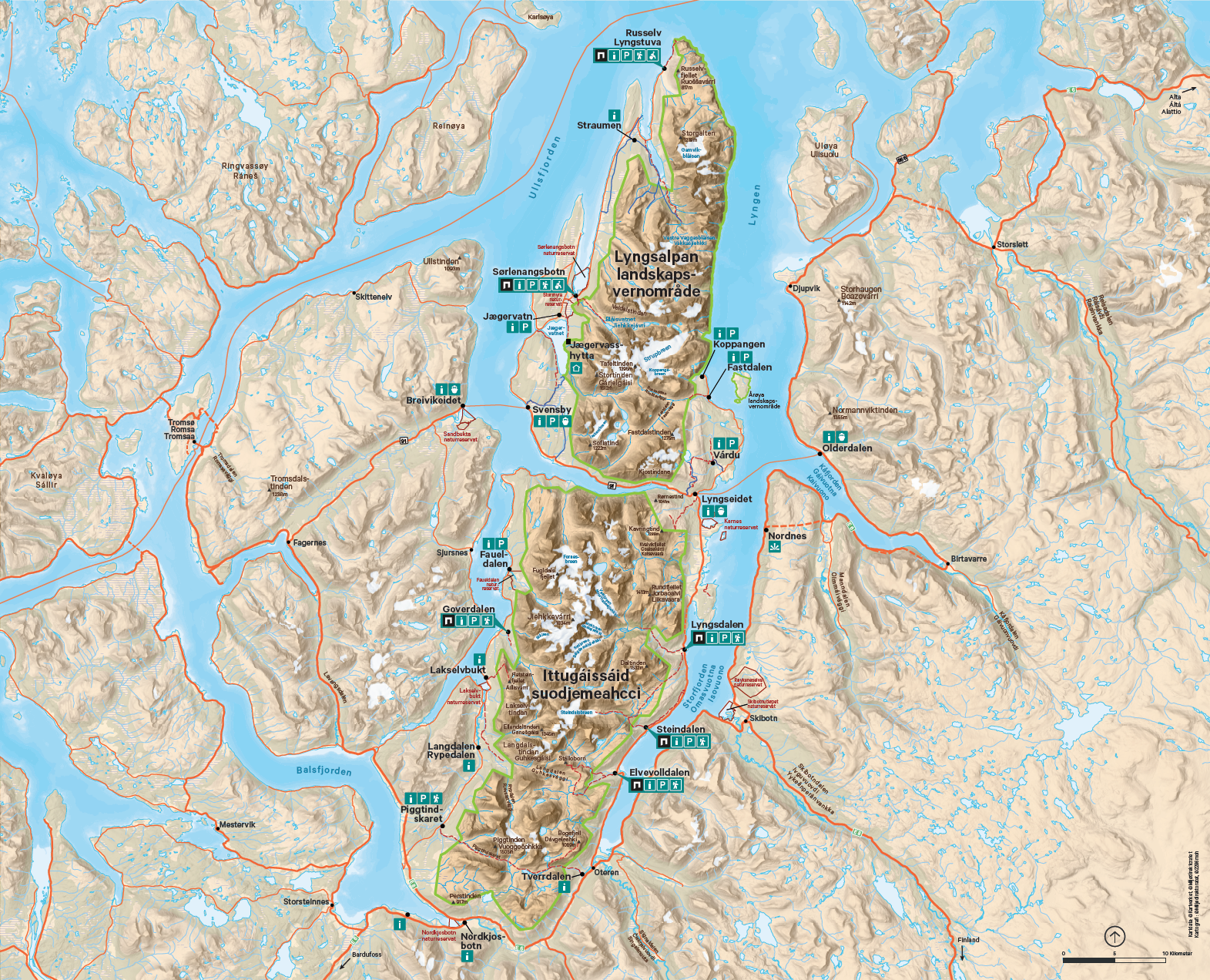
Lyngsalpan protected Landscape, or Ittugáissáid suodjemeahcci as it is known in North Sámi, sits on the Lyngen peninsula in Nord Troms. The Lyngen peninsula is situated between the two fjords Lyngenfjorden and Ullsfjorden. Lyngsalpan is the mightiest mountain range in North Norway with high mountains, sharp peaks and deep valleys. Troms and Finnmark's highest mountain, Jiehkkevárri, stands at 1834 metres above sea level in this area. The area has been an attraction for tourists since the end of the 1800s.
About the protected Landscape
Lyngsalpan forms a nearly 80-km long mountain range on the narrow peninsula between Ullsfjorden and Sørfjorden in the west, and Lyngenfjorden and Storfjorden in the east. The peninsula is never more than 15 km wide. The protected landscape area is a renowned landscape feature in which about 50 peaks in the mountain range tower more than 1300 metres above sea level. The height of the mountains serves as an effective barrier, trapping humidity from the clouds. This means that there are about 140 glaciers with a total area of nearly 100 km² in the protected landscape area.
Forneselva. Photo: Frode Abrahamsen
Summer in Dalbotn Lyngsdalen. Photo: Oddrun Skjemstad.
Lyngsalpan is more than just high mountains and rocky, inaccessible cliffs, however. On both the west side and the east side of the mountain range, there are wonderful and accessible valleys leading in between the mountains, in to the glaciers, moraine ridges and many beautiful glacial lakes.
The area has seen little human intervention and is not very developed, with only a few marked paths. Most paths are unmarked, however, and many of the paths are made by grazing animals. Some of the valleys have open cottages from the local association, and you can visit them to eat your packed lunch, or spend the night there. The general rule is that you bring your own sleeping gear.
Movie from the Lyngen Alps (Opens in new tab)
Why is it a protected Landscape?
The protected landscape area was protected in 2004 and covers an area of 961.2 km². The purpose of the protection is to;
- preserve one of Norway’s most characteristic mountain areas that includes glaciers, moraines, valleys and geological formations with the biological diversity, the cultural relics and the cultural influence marked by the landscape
- ensure access to nature experiences through traditional and simple outdoor life with a low degree of technical intervention.
- ensure access to nature experiences through traditional and simple outdoor life with a low degree of technical intervention.
Forklefossen. Photo Oddrun Skjemstad.
Information board Sørlensangsbotn. Photo Oddrun Skjemstad.
What is permitted?
Normal outdoor life, hunting and fishing can be done just like outside the landscape conservation area. In the landscape area, you can pick berries and edible mushrooms. You can also take firewood and make sticks for grilling. It is best if you let old, dead/dying trees stand untouched. These are important for insects and birds.
The landscape conservation area is protected against noise pollution. Among other things, this means that the use of drones and remote controlled planes is not permitted.
We also do not leave trash behind in nature – this also applies to the protected landscape area.
Official opening of Lyngsalpan Protected Landscape
The protected landscape area was officially opened on 17 June 2004 by HRH Crown Prince Haakon and then Environmental Protection Minister Børge Brende. It was a lovely event with food, speeches and entertainment at Sørlenangsbotn. After the event, the Crown Prince and the minister were given a trip up Forholtaksla above Jægervatnet.

